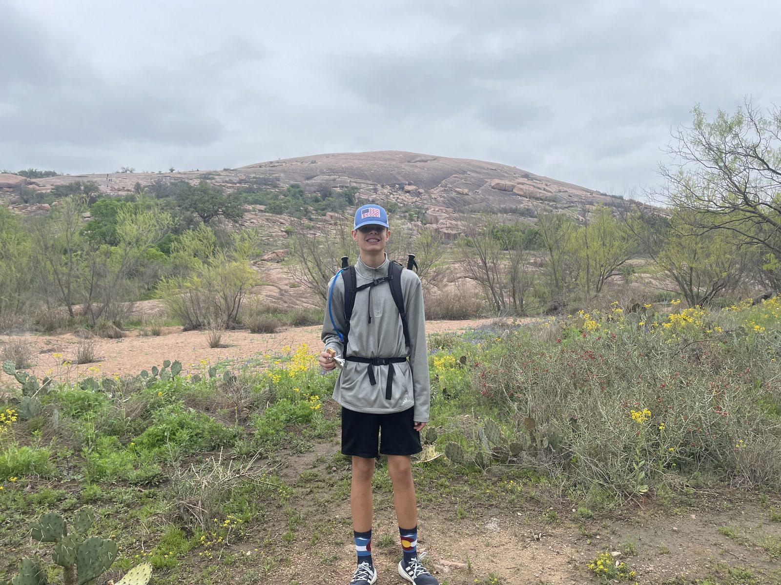
The Challenge
The troop's signature navigation test: summit all seven high points of Enchanted Rock State Natural Area using only a compass and a topo map — no phones, no GPS. About 7.5 miles and 1,660 feet of cumulative climbing over bare granite, oak woodland, and boulder fields.
| Distance | ~7.5 miles |
|---|---|
| Climbing | ~1,660 ft cumulative gain |
| Duration | Full day (day trip) |
| The seven peaks, in route order | 1. Unnamed peak (~1,705 ft) · 2. Little Rock · 3. Enchanted Rock · 4. Turkey Peak · 5. Freshman Mountain · 6. Buzzard's Roost · 7. Flag Pole |
| Trailhead | Enchanted Rock State Natural Area, Fredericksburg/Llano |
Route
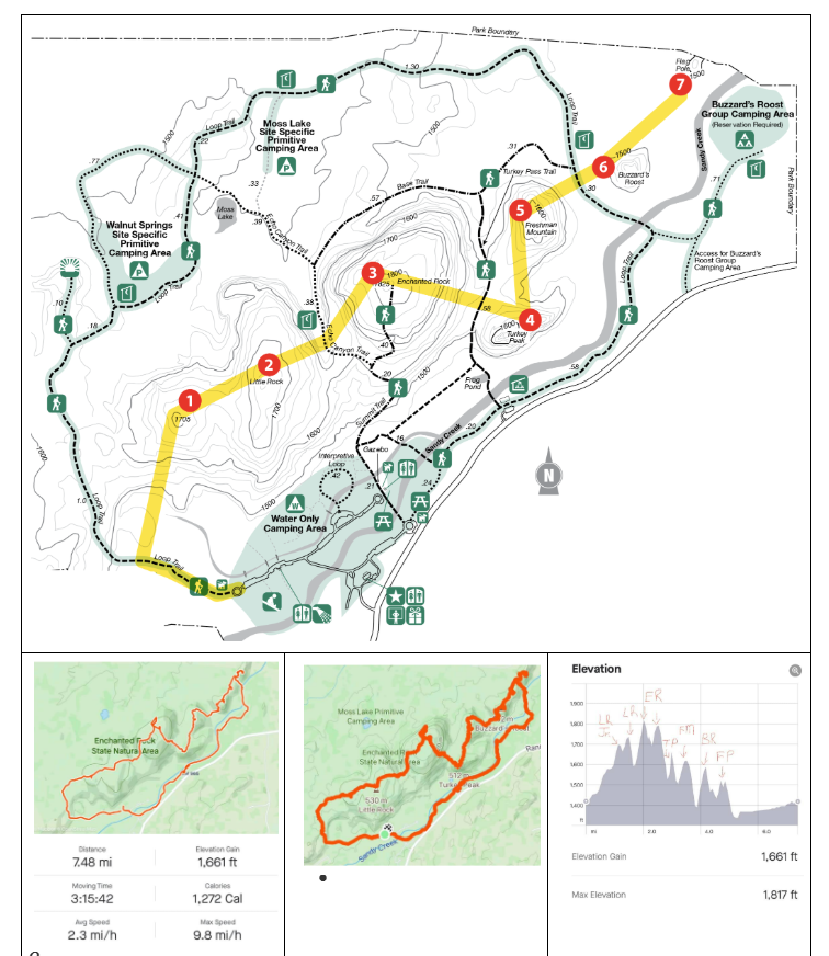
The troop's Seven Peaks route map — numbered summits with the recorded GPS trace and elevation profile.
Recorded track (~6.1 mi of the full route) with numbered summit markers. Markers are placed from the recorded track and are approximate — on this trip, the paper topo map and your compass are authoritative.
Conditions
3-day forecast — Enchanted Rock area
Burn bans (campfire rules)
Typical March (Fredericksburg area): highs near 70°F, lows near 44°F, with low rain odds. Spring fronts can still bring wind and cold snaps.
Safety Notes
Reservations are required and the park hits capacity — day passes regularly sell out weeks ahead in March. The trip doesn't happen without confirmed passes, so families should not buy their own; the troop reserves as a group.
Lightning is a hard no-go. The summits are exposed granite with nowhere to shelter. If thunderstorms enter the forecast window, the badge above goes red and leadership reschedules.
Carry your water. There is none on the granite, and March sun off the rock is stronger than it feels.
Packing List — Day Hike / Navigation
Compass and topo work is the whole point — every Trailman carries his own navigation kit.
Navigation kit
- Compass (each Trailman carries his own)
- Topo map of the park (troop provides — keep it dry)
- Route card and pencil
- Whistle
- Watch
On the granite
- Day pack
- Water: 2–3 liters (none available on the route)
- Sturdy shoes with grippy soles
- Sun shirt or loose long sleeve
- Wide-brimmed hat
- Sunglasses
- Sunscreen and lip balm
- Windbreaker (March fronts move fast)
- Light gloves for scrambling (optional)
Personal kit
- Lunch and trail snacks
- Personal first aid kit
- Headlamp (just in case)
- Hand sanitizer